We will get to Cantabria from the Basque town of Muskiz, following the coastline, and also the route along the coastal trails and roads, which has been slightly changed, of the Northern Route of the Way of St. James.
Cantabria is a Spanish autonomous community composed of only one province. The length of the coastal perimeter of Cantabria is similar to the one of the Basque Autonomous Community. We will traverse 177 km throughout the coast of Cantabria, and we will pass by its capital city, Santander.
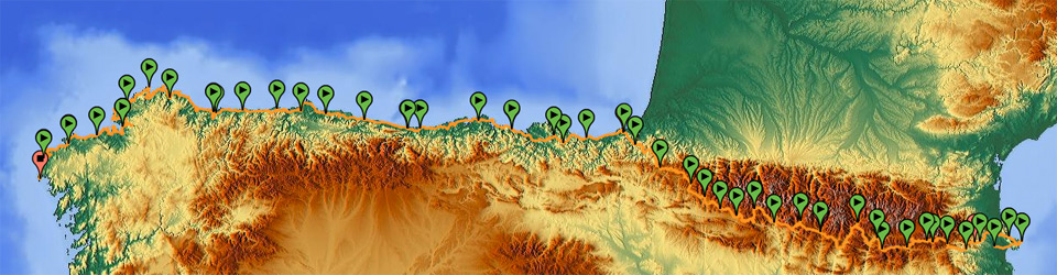
GPS Track with complete tour of Cantabria
Climate
The climate here is generally mild, oceanic along the coast, and Mediterranean in some parts of inland mountains. Since we will not go to the mountains in southern Cantabria, we don’t need to consider cold or hot weather; we only have to bear in mind that the weather will always be damp and temperatures will stay around 14 ºC.
Stages and slopes
The route along the coast of Cantabria can be followed in a very flexible way, since it is not necessary to plan stages taking into account altitudes and mountain passes, because the slopes are 150 m high at most. Using the GPS tracks on this website, you can easily do three stages of 60 km each, and have enough time to see everything that is worth seeing from a landscape and socio-cultural point of view.
The proposed route runs parallel to the coastline, but we will see the sea up close only during 50% of the route, since the rest of the trails and secondary roads cross coastal mountains and do not pass by the beach. The sea-mountain route, on the one hand, will let us visit places and towns that are usually unnoticed by the coastal tourist, and, on the other hand, it will make it easy for us to follow the current Way of St. James so, if we want, we can use the accommodation network and other lodges for pilgrims or non-motorized tourists.
Although Cantabria is quite a small province, our coastal route crosses many emblematic sites of cave paintings and prehistoric archaeological sites, such as museums and interpretation centres around paintings in the Cave of Altamira in Santillana, the Cave of La Fuente del Salín in Unquera, etc., or places of urban interest, such as the city of Comillas or the medieval village of Santillana.
If you follow the stages designed for the journey, using their tracks as a guide, you will be able to travel around Cantabria unhurriedly in about five days, but I also offer a single track for Cantabria, so that you can have a single route and can do the stages as you wish.
Alternatives to the stages of the route
A curious but short alternative to the route of the Way to St. James is the one I show in the track for Güemes to Santander through the coast, since my initial track (the one including all Cantabria) did not include the little towns of the coast after Güemes. It is only 12 km longer than the initial route, but it is worth getting away from the general road to end up in Santander, too, with the boat we will take in Somo.
Another route is the one aiming at avoiding a 6 km long trip we would have to travel to get to the river Pas bridge along the Boo de Piélagos-Oruña-Mogro route. We can skip it by taking the FEVE train in Boo de Piélagos and getting off in the next station, that is, Mogro. You can also get off in Requejada, to avoid passing by the mouth of river Saja and a 17 km long trip.
List of stages of the route by Cantabria