In this section, you will find specific notes on the Catalonian Pyrenees, and, at the bottom, there is some useful information about all the mountain range of the Pyrenees and its climate.
Our mountain bike trip does not start exactly in the Pyrenees, but very near, and also in the coast. Although the route starts in Cap de Creus, in the Catalonian region of Alt Empordà, the Pyrenees actually start in the coastal town of Llançà.
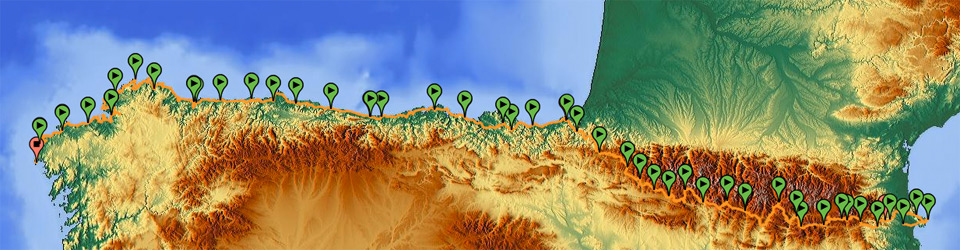
GPS Track with complete tour of the Pyrenees
Transpyrenean Tour by Mountain Bike
Llançà, a fishing town in the Mediterranean Costa Brava, is also the beginning of one of the mountain bike routes that has become most famous lately in the mountain extreme sports world: the Transpyrenean tour by mountain bike. It is a route based on mountain trails and ways, 95% suitable for cycling, designed to go near or in the middle of the mountain axis of the Pyrenees all the time.
The basic itinerary of the current Transpyrenean Tour is based on the book by Jordi Laparra, La travesía de los Pirineos en B.T.T. (Traversing the Pyrenees by Mountain Bike), first published in the 90’s if I am not mistaken, according to a journey experience lived by Laparra himself, with Alfons Valls and Jaume Bonaventura. This book was the basis for my first little trip by mountain bike in the Pyrenees that I did with some college mates in 1996.
In April 2013, another book was published by Prames, the publishing house that had published Laparra’s book; with the title La gran travesía de los Pirineos en B.T.T. de mar a mar. Del Mediterráneo al Cantábrico (The Great Journey across the Pyrenees by Mountain Bike, from the Mediterranean Sea to the Cantabrian Sea), written by Miguel Ángel Acín and Fernando Lampre. I haven’t read it, but according to the summaries, it extends the route proposed by Laparra and his mates a little more, it has fewer maps, and it includes links to download tracks.
What I think is that right now there is enough free, quality, and contrasted documentation on the Internet, in several languages, so it is very interesting to make your own and genuine route, for example, based on Wikiloc users’ GPS tracks, discussions and opinions of other people in specialized web forums, tourist information, and blogs written by people who share their experiences. It is useful to have a book as a guide, but it is not essential if we can get documentation, experiences and direct dialogues with other cyclist in a web page beforehand.
In my case, Laparra’s book happened to be sold out in the publishing fund, and I didn’t try really hard to find it in bookstores which could have still been selling it. When I planned the trip around the northern Iberian Peninsula, in September 2012, the new book had not been published yet, and by April 2013, I had already planned the itineraries so carefully that it wouldn’t have helped a lot. Those who only want to do the Transpyrenean tour can use Zinaztli’s tracks in Cicloide.com, or Anibal’s in Wikiloc.com, which are excellent examples. For an extension including Cap de Creus or San Sebastián/Donostia, you can use the tracks found in this website, which also propose an alternative that is more suitable for cycling and that avoids some of the major difficulties in some geographical points in case of bad weather conditions in the Pyrenees, such as lots of snow build-up or forest trails that are not in good conditions.
- Transpirinaica: a Spanish website with useful information and accommodation services
- The Zinaztli’s Blog, excellent narration in Spanish of the Transpyrenean. I used their GPS tracks
Stages in the coast to coast route along the Catalonian Pyrenees
It is one of the areas with most changeable weather, with strange and abrupt changes, but it is also a good place for endurance training since the slopes are generally smooth and the routes are long, so the mountain passes are not extremely difficult, but for a few critical points.
In Catalonia, it is easy to divide a stage into two, and spend the night in towns where there is a campsite, for example, since we have a good accommodation offer and there are many towns. After that, there are fewer chances of finding lodges in the same place where we are tired and want to spend the night.
Natural Parks in Catalonia
The Transpyrenean tour crosses the mountain range approximately through the axis, so you cross 9 out of the 11 regions that share some land in the Catalonian Pyrenees: Alt Empordà, Garrotxa, Ripollès, Cerdanya, Berguedà, Alt Urgell, Pallars Jussà, Pallars Sobirà, and Alta Ribagorça.
Likewise, you cross some natural parks, such as Cadí-Moixeró and the Parc Natural del Cap de Creus, and you pass by some peripheral areas of other places, such as the Parc Natural de l’Alt Pirineu and the Parc Nacional d’Aigüestortes i Estany de Sant Maurici.
More info. Map, tourism, and institutional information in English: http://www.visitpirineus.com/Html/Ingles/default.asp?
Travelling and camping in the Pyrenees. Generalities. Climate.
To traverse the Pyrenees, we will have to travel more than one thousand kilometres, and we have to bear in mind that there are extreme weather conditions, even in times that could be good in most areas, such as spring or summer.
The only precautions we have to take into account when we develop a route such as the Transpyrenean route is that, in areas near the Mediterranean Sea, and in low watersheds, we will have Mediterranean climate, and from an altitude of 1,500 m, there will be a Sub-Alpine and an Alpine climate. In our coast to coast route, we won’t find an Atlantic climate before Navarre, but in some alternatives to the Transpyrenean route that are popular now, we do find this climate when we enter the Aran Valley.
What we need to know is that, as we go from east to west, at the same altitudes, following the preset route in this web site, rainfall tends to increase and temperatures tend to be lower. If we go from south to north, for example, rainfall also tends increase and temperatures also tend to get lower. Storms will always be frequent, but on the ridges, they are particularly ferocious.
All this is important if we have to sleep in the middle of the mountain or in a campsite, or if we have to do long journeys at high altitudes, since we have to take into account that the orientation of the mountain slope will determine the conditions under which we will travel:
- South-oriented slopes are dry and have more sunshine, and there are more extreme snow freezing and melting processes. They can be distinguished because, in spring, plants sprout and bloom long before other places, so they have more vegetation.
- North-oriented slopes are damp and there is less sunshine, there isn’t so much vegetation, and the snow is more stable, which means that it stays frozen without major changes.
List of stages of the route by the Catalonian Pyrenees
- Stages 1 and 2: Figueres – Cap de Creus – El Port de la Selva
- Stage 3: Llançà – Sant Llorenç de la Muga
- Stage 4: Sant Llorenç de la Muga – Montagut i Oix
- Stage 5: Montagut i Oix – Camprodon
- Stage 6: Camprodon – Ribes de Freser
- Stage 7: Ribes de Freser – Planoles
- Stage 8: Planoles – Bagà
- Stage 9: Bagà – Fòrnols
- Stage 10: Fòrnols – La seu d’Urgell
- Stage 11: La Seu d’Urgell – Sant Joan de l’Erm – Llavorsí
- Stage 12: Llavorsí – El Pont de Suert
Pingback: under a Catalan sky | (Un)Inspired Ramblings