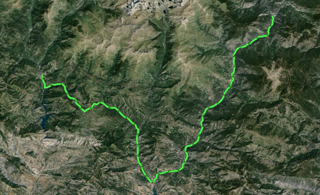
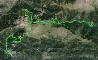
 It wasn’t part of the plan to skip a mountain day, but it was raining a little, and it is not safe to go into the mountains with a bad weather forecast. I prefer to stay in the region and go sightseeing, since Ainsa is close and has some cultural attractions. The tour consists in travelling from the campsite to Ainsa, eating there at midday, and coming back to have dinner at the campsite.
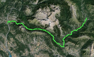
In Ainsa, you can visit the old town, with an interesting gastronomic offer. For those who are interested in visiting museums, there are two which allow interpreting the village of Sobrarbe: an ecomuseum, about the natural environment of flora and fauna, and a geospace interpretation centre, also of the village, with information about the development of the iron mining business, and the geological structure of this part of the Pyrenees. Both museums can be visited completely in about three hours.
Trip to Ainsa in Wikiloc: http://en.wikiloc.com/wikiloc/view.do?id=4996657
GPS Track for trip to Ainsa download: http://goo.gl/VP5ajm
Distances: Valle Añisclo campsite – Ainsa – Valle Añisclo campsite 25 km

Descarregueu el track amb BIDI QR
Excursión a Ainsa en castellano · Excursió a Ainsa en català
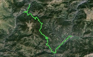
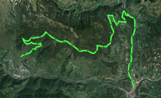
 Today, I have returned to the Transpyrenean route —I’ve been to Campo by road and, from there, to Senz through trails. All the way was up and down, quite difficult due to slopes and the poor conditions of the forest trails. The weather is unstable, and I have found snow along the way, the same I could avoid in Catalonia by taking alternative road routes.
 In this stage, I get to Aragón, just after leaving El Pont de Suert, and get into the region of Ribagorza.
 I go straight to El Pont de Suert by road, since the route I was supposed to take cannot be followed these days. The weather conditions are terrible, and there are several meters of snow on the trails around Parc Nacional d’Aigüestortes. They cannot be used until they are cleaned or the snow melts.
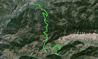
 I come back to La Seu d’Urgell and resume the way I left in October 2012. I arrived in La Seu d’Urgell by public transport and take Lleida road towards Pla de Sant Tirs. It is raining and hailing, so the weather in May 2013 is much worse than October 2012, but I hope it gets better within the next few days.
 Yesterday, October 9, I carried out a thorough search of all the lodgings that will be open in the Pyrenees throughout the fall. It is not certain whether some of those which were supposed to be open this season will finally offer services, because the mushroom season has been delayed and they cannot have the facilities empty, waiting for guests. On the other hand, the establishments which are always open are pretty expensive for the budget I have planned, and there is no guarantee that there will be available lodgings on the stages I have planned, even making small changes.
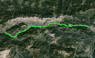 The stage shouldn’t be Bagà – Fòrnols, but it should be up to Pla de Sant Tirs, but I was confused several times along the ways, and it made me waste a lot of time. I preferred to stay at “Molí de Fòrnols” campsite; going back, I had pedalled 58 kilometres and I had not reached the village of La Barceloneta yet. The track I provide here ends at the campsite.
 It is a long stage as compared to the previous ones, but normal length in the classic Trans Pyrenees tour.
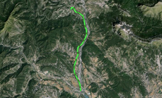
 It is a short stage, due to some mechanical incidents with my bike, which made me stop for some hours before leaving Ribes. In the end, I have only pedalled for three hours, and I have devoted my time to being a tourist in the settlements I’ve crossed.
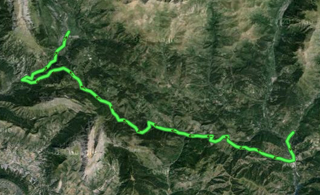
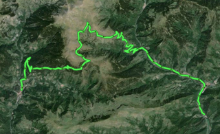 We leave the campsite and go along the road to Camprodon, go on up to Vilallonga de Ter, and after going up a little more, we leave the road and take trails in good conditions up to the two core areas of Tregurà, about 14 km away from our starting point. From Tregurà to Ribes de Freser, we won’t find any other population in 28 km, so we will have to gather water and food before we set off.