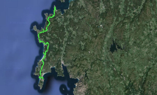
 This is the last stage of our route, and it is short and nice to do. Then, we have different alternatives to leave Costa da Morte, although I will go to Santiago de Compostela by road, and there I will use public transports to go back to Catalonia.
I leave Muxía a little late because I have to fix a flat tire, and due to the delay, I meet a guy who is a member of Traski (see Resources), a mountain group promoting hiking routes along Costa da Morte following the paths I have followed on my way here.
I start going down to Muxía, along Cape Touriñan and the following beaches, a place that is quite isolated from usual tourists, mostly from the Way and going along other interior routes. Our route runs opposite to the one followed by pilgrims, and for more than half of the way, we won’t meet pilgrims.
From Lies, in the middle of today’s stage, we start travelling along pilgrimage tracks, and we meet many people walking in the opposite direction. A few kilometres before Fisterra, we divert rightward and enter the town on the west, through San Martiño, just opposite to the pilgrims’ entrance.
I sleep in Fisterra’s public hostel, and I go out at night to celebrate that I have finished my 44 day bicycle trip, plus the days I spent sightseeing or resting in a campsite or hostel. I have discovered one of the destinations that should be emblematic for pilgrims in Fisterra: the library-bar A Galeria, owned by the Galician writer Roberto Traba Velay, a person I am happy to have met.
If you have been patient enough to read this travel log so far, I sincerely thank you, and if you are interested in telling me something, you can use the comments system or enter de section “About me”, and send me a message. I hope you enjoyed the reading, and I encourage you to use this route to plan a similar trip and discover hundreds of places, and even other places I couldn’t visit.
Stage 44 in Wikiloc: http://en.wikiloc.com/wikiloc/view.do?id=4973684
GPS Track for Stage 44 download: http://goo.gl/KJhH3A
Distances: Muxía – Fisterra 48 km
List of villages:

Download track 44 with QR BIDI
Muxía
Lourido
Cuño
Martineto
Viseo
Moreira
Touriñan
Talón
Santo Estevo de Lires
A Canosa
San Martiño
Fisterra
Price of accommodation: 6 euros.
References: A Galería, library-tavern. Rua Real, 25. Fisterra.

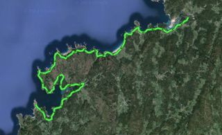 I go to Ponteceso from Filgueira, and go on towards Muxía along the planned coastal route. This stage becomes long and is complicated in several points, since it has trails that are not suitable for cycling, coastal forest trails, and coastal roads.
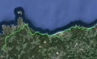 Today’s stage is very intense as regards paths near the water, since most roads and tracks are completely along the coast or cross little coastal forests between one beach and the other. It is also short, but with constant slopes up and down, so you get really tired at the end of the day.
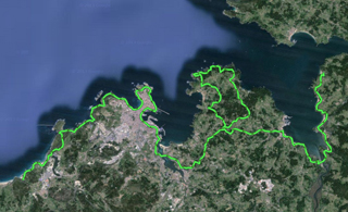 This stage is long but easy, and has amazing landscapes. The first part, about 20 km long, circles the sea inlet of Betanzos up to the beach of Sada, and is done along roads next to the beach. From Sada, we take roads that lead us to the end of the coast of Dexo, and we go down towards Corunna. Most routes have nearby towns, but our route avoids urban zones as far as possible.
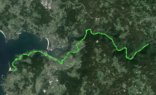 This stage wasn’t planned, but since I am only 20 km away from the monastery of Caaveiro, I’ve decided to go up there and visit the forest of river Eume. It will be the third forest I visit after La Garrotxa and Irati. It is a circular tour about 40 km long which can be planned for a whole day, and I have included it here as if it were another stage.
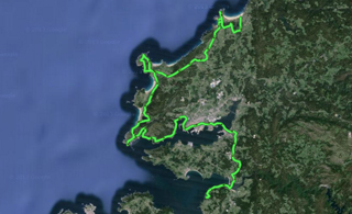 Today, daybreak was sunny. I leave the campsite taking secondary roads, I pass by the A Frouxeira pond, and after As Gorgas, I get to a forest trail which is very badly maintained, so I have to drag my bike for quite a few kilometres until I reach a flat top hill about 300 m high, called A Lagoa. In the middle of the plain, there are ruins of military bases and a geodetic survey monolith, everything very curious and different from what I have seen so far. The routes cross the hills and get to beach towns, such as A Fonte da Tella.
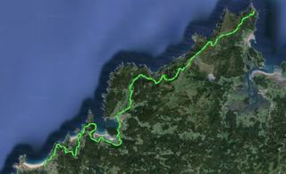 I pedal again until I am near Cape Ortegal, and I cross the peninsula to go up to Teixido along Ruta dos Miradoiros. There is a wet forest and paved forest trails which lead us to the shrine of Santo André de Teixido, near the highest cliffs in continental Europe, and the wind hampers going by bike, but it is worth seeing, at least on foot. There is a popular saying — “A Santo Andrés de Teixido vai de morto o que non foi de vivo”, that is, those who couldn’t visit San Andrés de Teixido when they were alive will go there after death.
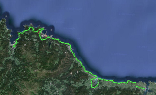
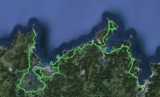 Today is an excellent day, and the slopes expected for this stage are not hard, but for the ones up Cape Ortegal. I leave Viveiro heading to the western coast of the sea inlet, and I pass by villages that are not very populated, up to O Vicedo and Bares, a very nice bay we have to circle. From there, we will turn to Barés and get to the sea inlet of Ortigueira.
 Yesterday, I read in
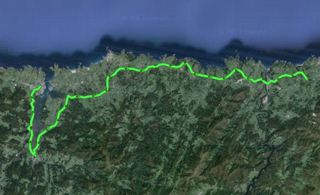 This is the stage in which we enter Galicia and we will stop running parallel to the Northern Route. It may be short or very long, depending on how much we want to pedal, since it may be 55 km or 35 km long based on what we choose —taking the crossing boat in Castropol or cycling around the sea inlet.
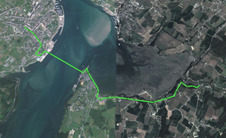 If, when we are near Ribadeo, we want to take the little water-taxi, we will have to go down the right part of the town, along Galicia Avenue, and then go towards the pier walkway. In this Web site,
